Georgia is experiencing a severe winter storm that is expected to last from February 5 to February 8, bringing snow, strong wind, and other hazardous weather conditions to the country. The National Environment Agency has issued a weather forecast and a warning for the public to be prepared and cautious.
Snowfall and Blizzard in Western Georgia
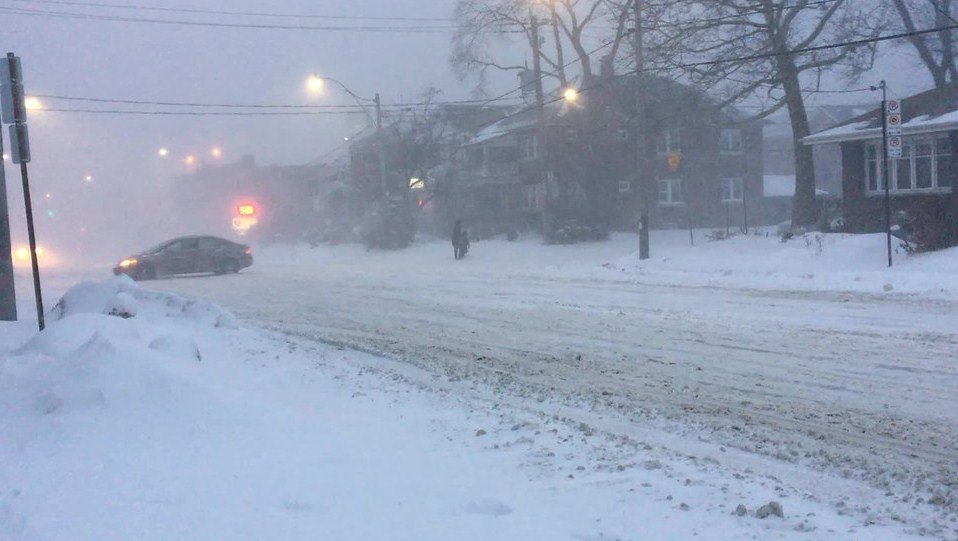
According to the forecast, precipitation, mainly in the form of snow, will occur in most parts of Georgia, with heavy snowfall anticipated in some places, particularly in the western part of the country. The snow depth may reach up to 30-40 cm in some mountainous regions, and up to 10-15 cm in lowlands. The snowfall will be accompanied by fog and blizzard, reducing visibility and creating slippery roads.
The National Environment Agency warns that there may be restrictions on traffic on certain sections of highways, especially where heavy snowfall, poor visibility, blizzards, and ice pose risks. Drivers are advised to use winter tires and chains, and to avoid unnecessary travel. The Agency also urges the public to follow the instructions of the emergency services and local authorities.
Strong Wind and Sea Storm in Eastern Georgia
The storm will also bring strong wind to the eastern part of Georgia, especially on February 6. The wind speed may reach up to 25-30 m/s in some areas, causing damage to trees, power lines, and buildings. The wind will also affect the Black Sea coast, creating waves up to 4-5 meters high and a strong sea storm up to 6 points.
The National Environment Agency warns that the strong wind and sea storm may pose a threat to the lives and property of the coastal residents and visitors. The Agency advises the public to avoid swimming, fishing, boating, and other water activities, and to stay away from the shore and cliffs. The Agency also recommends the public to secure their windows, doors, roofs, and other objects that may be blown away by the wind.
Landslide and Avalanche Risk in Mountainous Regions
The abundant precipitation may also cause swelling of small rivers and the formation-activation of landslide and avalanche processes in the mountainous regions of Georgia. The risk of avalanches is especially high in the Greater Caucasus Range, where the snow cover is unstable and thick.
The National Environment Agency warns that the landslide and avalanche risk may endanger the lives and property of the mountainous residents and visitors. The Agency advises the public to avoid traveling to the avalanche-prone areas, and to follow the instructions of the mountain rescue teams and local authorities. The Agency also suggests the public to monitor the water level of the rivers and streams near their homes, and to report any signs of landslide or avalanche to the emergency services.
How to Stay Safe and Informed
The winter storm is expected to last until February 8, with some improvement in the weather conditions on February 9. The National Environment Agency will continue to monitor the situation and provide updates and warnings as needed. The public can also access the latest weather information and forecasts on the Agency’s website1
The public is also encouraged to participate in the Severe Weather Preparedness Week, which takes place from February 5 to February 9, in collaboration with the Georgia Emergency Management and Homeland Security Agency and the National Weather Service. The week aims to raise awareness and educate the public on how to prepare for and respond to different types of severe weather emergencies, such as thunderstorms, tornadoes, lightning, and floods. The public can find more information and resources on the Ready Georgia website or mobile app.
The winter storm is a serious and potentially life-threatening situation that requires the public to be alert and prepared. By following the weather forecast, the warnings, and the safety tips, the public can protect themselves and their loved ones from the storm’s impacts.