A powerful line of storms is hammering metro Atlanta and parts of North Georgia, with a tornado watch in effect until 4 a.m. Sunday. Residents in multiple counties are on high alert as weather officials warn of potential tornadoes, heavy rain, and dangerous winds.
Metro Atlanta Counties Brace for Impact
The National Weather Service (NWS) has expanded the tornado watch to cover a broad swath of northeast and southwest Georgia. This includes some of the most densely populated metro Atlanta counties — Fulton, Clayton, Cobb, DeKalb, and Gwinnett — leaving thousands of residents glued to weather updates.
Officials are urging residents in affected areas, including Paulding, Cherokee, Coweta, Henry, Spalding, Forsyth, Fayette, Hall, Rockdale, and Douglas counties, to stay indoors and remain vigilant. The storm system is expected to barrel through the region overnight, making visibility poor and road conditions treacherous.
“We’re asking everyone to stay off the roads unless absolutely necessary,” the NWS stated. “Storms like these can spawn tornadoes quickly, and travel could become life-threatening.”
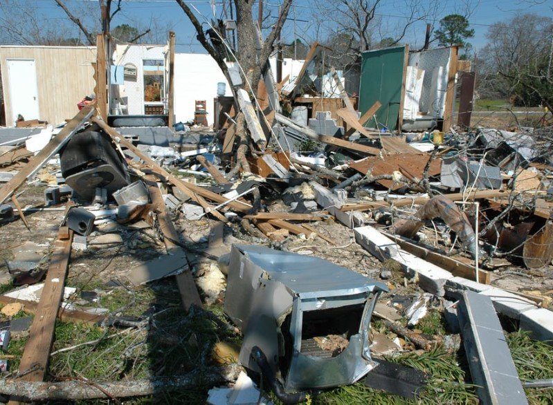
Tornado Warnings and Early Damage Reports
As the storms rolled in Saturday night, tornado warnings were swiftly issued for several counties, including Cobb, Paulding, Cherokee, Gilmer, and Fannin. By 12:15 a.m., southeastern Paulding, southwestern Cherokee, and northern Cobb counties were under direct warning as radar indicated rotation within the storm.
Some North Georgia residents didn’t wait for the alarms — intense winds and heavy rain prompted many to seek shelter before midnight. Emergency services reported trees down in multiple areas, with South Fulton hit particularly hard. A fallen tree blocked Camp Valley Drive and Benidorm Court, while Cherokee County saw several roads closed due to storm debris.
Power outages piled up fast. By midnight, more than 60,000 homes and businesses were without electricity. Georgia Power reported 25,000 outages, most concentrated in northwest Georgia and metro Atlanta.
Travel Nightmares and Flooded Roads
The first wave of storms hit far northwest Georgia around 8 p.m., creeping into metro Atlanta by 11 p.m. and continuing eastward. By 2 a.m., the system was expected to sweep through downtown Atlanta, with heavy rain and gusty winds making driving perilous.
The Troup County Sheriff’s Office warned drivers to avoid the roads altogether. “Highly recommended to not drive until the storms have passed in the morning,” the department said in a late-night travel advisory.
Several major roads were blocked by fallen trees and debris. Early Doppler radar estimates showed staggering rainfall totals, especially in West Georgia:
- Carrollton, Carroll County: 4.1 inches of rain
- Cedartown, Paulding County: 3.4 inches
- Atlanta: 0.03 inches
Flooding remains a major concern, with the saturated ground making it easier for trees to topple and roadways to become impassable.
What Comes Next
Forecasters predict the severe weather will continue moving eastward through the night, finally clearing Georgia by 8 a.m. Sunday. But the damage may take much longer to clean up.
Utility crews are already mobilizing to restore power, and road crews are working to clear blocked highways. Emergency responders are urging residents to report downed power lines, trees, and any other hazards — but to stay indoors if possible until the weather clears.
For now, all eyes remain on the radar. Georgians know how quickly these storms can turn, and with memories of past tornado disasters still fresh, no one is taking chances tonight.