Delhi and much of northwest India are reeling under a brutal heatwave with red alerts issued, while parts of the south, like Karnataka, face relentless monsoon rains. IMD has stepped in with warnings, hopes, and forecasts. But the weather, as always, has the final say.
Heatwaves Grip the North, With Delhi at the Epicentre
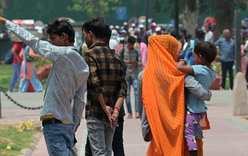
The capital city is blazing. Temperatures in parts of Delhi have surged past the 46°C mark, pushing the India Meteorological Department (IMD) to issue a red alert—a rare and alarming move that underscores how severe the situation really is. Gurugram, Noida, and large swathes of Punjab, Haryana, and Rajasthan are all under the same category of risk.
This isn’t just another hot day. It’s life-threatening for many—especially the elderly, children, and outdoor workers.
In areas like Najafgarh, Mungeshpur, and Narela, street vendors wrapped their faces in damp cloths, clutching water bottles like lifelines. Locals reported taps running warm even at dawn. That’s how early the heat begins to bite.
And it’s not just about discomfort anymore. Hospitals across the region have noted a surge in heatstroke cases. Ambulance calls have spiked. Even air conditioners are struggling to keep up.
IMD Offers a Sliver of Hope Starting June 14
Relief might be on the way—finally. The IMD says a shift in wind patterns and the potential advancement of the southwest monsoon could bring rain and a drop in temperatures by Friday, June 14.
But until then? The advice is simple: stay indoors, stay hydrated, and avoid strenuous outdoor activity.
For Delhi, the next two days are going to be harsh. Night temperatures aren’t dropping much either, which adds another layer of stress to the human body. This combination—high day and night temperatures—is particularly dangerous.
Here’s a quick glance at the projected weather path, according to the IMD:
| Region | Alert Level | Current Avg Temp | Relief Expected |
|---|---|---|---|
| Delhi | Red | 46.2°C | June 14 |
| Punjab | Red | 44.8°C | June 14 |
| Haryana | Red | 45.3°C | June 14 |
| Rajasthan | Red | 45.9°C | June 14 |
| J&K, UP, Himachal | Orange | 41–43°C | June 15–16 |
One sentence here—Delhi can’t catch a break this week.
South Drenched, North Fried: India’s Weather Puzzle
While the north is being scorched, southern India is playing out a different drama altogether. Bengaluru, parts of coastal Karnataka, and western Maharashtra are under red alerts too—only this time, it’s for torrential rainfall.
On Wednesday night, Bengaluru witnessed flash floods in low-lying areas like Koramangala and HSR Layout. Trees were uprooted, roads turned into rivers, and traffic crawled to a standstill.
A school in Whitefield declared a sudden closure as classrooms were swamped by overnight rainwater. And yet, oddly enough, just 10 km away, areas like Hebbal reported dry skies. Classic Bengaluru weather, right?
This is what makes forecasting in India such a tightrope act. You’ve got to deal with two extreme ends of the spectrum at the same time.
Who’s Most Affected and What Authorities Are Doing
Let’s talk damage—and action. It’s clear that the worst-hit are those with the fewest options.
• In Delhi, rickshaw drivers and construction workers continue to toil under the sun.
• In Bengaluru, it’s the informal settlements and roadside vendors who lost stock and shelter to rain.
• In Rajasthan, farmers waiting for monsoon showers now face dry fields and mounting anxiety.
Governments aren’t sitting idle, though.
-
Delhi: Free water stations have been set up across Connaught Place, Lajpat Nagar, and major Metro exits.
-
Bengaluru: BBMP (Bruhat Bengaluru Mahanagara Palike) has deployed emergency teams to clear drains and remove fallen trees.
-
Punjab and Haryana: School timings have been shifted earlier in the day to avoid peak heat.
There was even a bizarre moment in Jaipur where locals poured buckets of water on overheated asphalt to cool it down. Not scientific, sure—but desperate times.
How Long Will This Pattern Last?
Here’s the tricky part. While IMD forecasts a change from June 14, experts warn that global weather anomalies—like El Niño—are still influencing subcontinental weather patterns.
The monsoon’s northward progression has slowed down. Typically, it should have already reached parts of central India by now. But this year, it’s dragging.
At the same time, the Indo-Gangetic plains are acting like a heat trap, with warm air unable to escape quickly at night.
The IMD expects:
-
Rainfall intensity to increase over Karnataka and Kerala over the next three days
-
A gradual drop of 3–4°C in maximum temperatures across northwest India starting Friday
-
Monsoon to reach Madhya Pradesh and Chhattisgarh by June 16
So, while it’s still looking rough, there’s light at the end of this weather tunnel. Just not today.