
A powerful winter storm brought rare snowfall to parts of Florida and Georgia on Sunday, January 19, 2025, creating excitement across the Southeast before the frozen spectacle melted away by afternoon. The same storm system continued its march northward, delivering significant snow to the Northeast with additional accumulation expected through Sunday night.
Southern States Wake Up to Unusual Winter Wonderland
Residents across the Florida Panhandle and parts of Georgia woke up to a sight many rarely witness. Snow blanketed cars, lawns, and rooftops in cities like Pensacola, Florida, where dealership lots turned white and children rushed outside to play.
The National Weather Service had issued a winter storm warning for the northwest portion of the Florida Panhandle earlier in the day. However, officials lifted the warning by afternoon as temperatures climbed and the snow quickly disappeared. The fleeting nature of the event did not stop locals from capturing photos and videos to share on social media.
In Georgia, a narrow corridor stretching across north and central portions of the state received measurable snowfall. The National Weather Service office in Atlanta confirmed that some areas saw up to three inches of accumulation. Monticello, a small city located about 65 miles southeast of Atlanta, recorded the highest totals with a full three inches of snow on the ground.
How Rare Is Snow in Florida and Georgia?
Snowfall in the Deep South remains an uncommon occurrence. Florida, known for its beaches and warm temperatures, sees measurable snow only once every few years in its northern regions. The Panhandle experiences snow more frequently than other parts of the state, but accumulations of an inch or more are still considered rare events.
| Location | Snowfall Amount | Last Significant Snow Event |
|---|---|---|
| Pensacola, FL | Trace to 1 inch | February 2021 |
| Monticello, GA | 3 inches | January 2022 |
| Atlanta, GA | 1 to 2 inches | January 2022 |
| Tallahassee, FL | Trace amounts | February 2021 |
Georgia sees snow more regularly in its northern mountain regions, but cities like Atlanta and areas further south typically receive significant snowfall only a handful of times each decade. When it does happen, the region often struggles with road conditions since infrastructure and driver experience for winter weather remain limited.
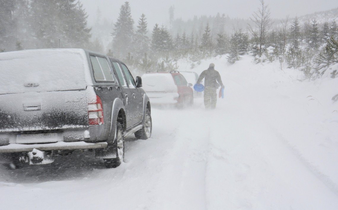
Storm Moves Northeast With More Snow Expected
After dusting the Southeast, the winter storm pushed up the East Coast and into New England. Forecasters predicted the system would continue producing snow through Sunday night, with several inches expected across parts of New York, Connecticut, Massachusetts, and other northeastern states.
The storm brought a one two punch to some areas. A first round of snow fell during the morning hours, followed by a brief break before a second wave arrived Sunday evening. This pattern created challenging travel conditions for millions of residents returning from weekend activities.
Key impacts from the storm include:
-
-
- Flight delays and cancellations at major airports along the East Coast
- Hazardous driving conditions on highways and secondary roads
- Power outages in areas where heavy snow accumulated on trees and power lines
- School closures announced for Monday in several districts
-
Why Did the South Get Snow This Time?
The snowfall in Florida and Georgia resulted from a combination of factors that aligned perfectly. A strong cold front pushed arctic air deep into the Southeast late last week, dropping temperatures well below normal. When the moisture from the approaching storm system collided with this cold air mass, the result was snow instead of rain in areas that usually stay too warm.
Meteorologists note that these conditions require precise timing. If the cold air arrives too late or the storm moves too quickly, the precipitation falls as rain. In this case, temperatures in parts of the Florida Panhandle dropped into the mid 20s overnight Saturday, setting the stage for frozen precipitation.
Climate experts say these types of events may become more unpredictable in coming years. While overall warming trends continue, individual weather patterns can still produce extreme cold snaps that push unusually far south.
Residents Embrace the Brief Winter Moment
Social media platforms lit up with posts from excited residents across the South. Parents shared videos of children building snowmen and throwing snowballs. Pet owners posted clips of dogs experiencing snow for the first time. Local businesses captured images of their storefronts covered in white.
The quick melt did not dampen spirits. Many residents expressed gratitude for the brief winter experience, knowing such moments come rarely to their part of the country.
“We knew it would not last, so we got outside early,” one Pensacola resident posted online. Schools may have been closed, but the snow day turned into an impromptu community celebration in neighborhoods across the affected areas.
What Comes Next for Weather Across the Region
Temperatures across the Southeast are expected to rebound quickly. By Monday afternoon, highs in the Florida Panhandle will climb back into the 50s, with Georgia seeing similar warming. Any remaining traces of snow will disappear completely within 24 hours.
The Northeast faces a different situation. Cold air will linger through midweek, keeping temperatures below freezing and preserving snowfall on the ground. Additional storm systems are being monitored for later in the week, though forecasters say it remains too early to predict specific impacts.
For residents of Florida and Georgia, this rare snowfall will become another memorable weather story. Those who missed the morning flurries can only hope the next winter storm brings another opportunity to see their hometowns transformed, even if just for a few hours.
Did you experience the rare Southern snowfall this weekend? Share your photos and stories in the comments below, and pass this article along to friends and family who might have missed the excitement.